MVRsimulation delivered 16 Virtual Reality Scene Generator licenses to Bell Flight
The helicopter company has been using the system on multiple platforms, including the V-280 Valor.
Advertisement
On a post on their LinkedIn page, MVRsimulation lets us know more about the system, which includes a new airport.
Here is the post (edited for clarity):
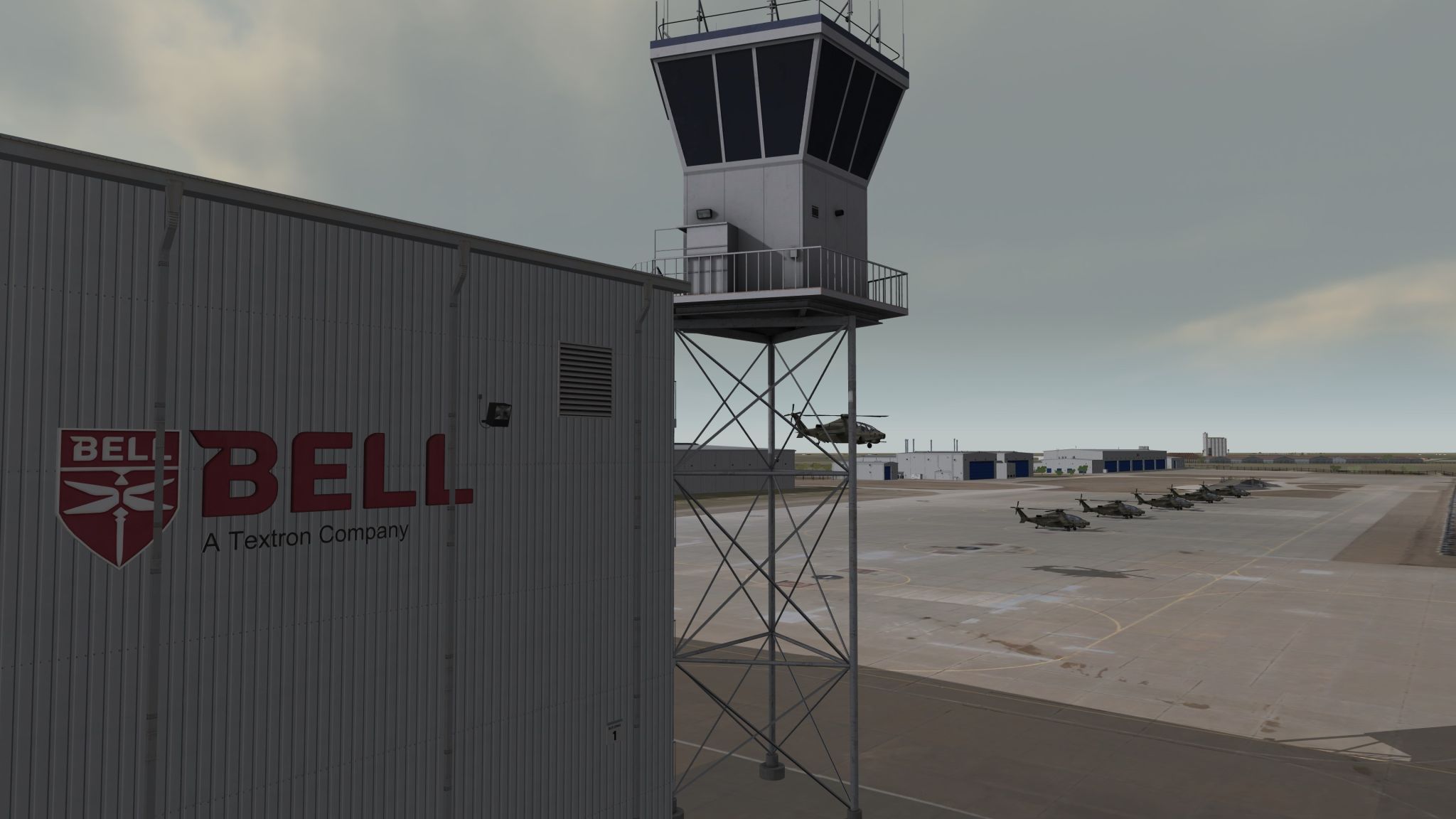
MVRsimulation has recently delivered 16 Virtual Reality Scene Generator (VRSG) rack mount IG licenses to our long-time customer Bell Flight, along with our brand new Rick Husband Amarillo International Airport (KAMA) terrain.
Bell uses VRSG during flight control development for multiple platforms, including the AH-1Z Viper, V-22 Osprey, V-280 Valor, and the V-247 Vigilant.
VRSG is installed at Bell’s engineering lab in Ft. Worth, TX, as part of a large dome-based system that allows cockpits/chassis to be wheeled in and out.
The new rack mount system will run our new high-resolution geospecific 3D KAMA terrain – pictured here in a real-time VRSG scene with Bell360 Invictus entities.
The KAMA terrain is comprised of 5 mm per-pixel and 2 cm drone imagery of the airport (14 sq km), 30 cm Maxar imagery of the airport, and 30 cm Texas Open Data imagery of the #Amarillo metropolitan area blended to 1m NAIP base imagery of CONUS++ terrain. The elevation source includes 70 meter elevation data of the airport blended to 10 meter NED data of Amarillo and underlying DTED-1 base elevation.
This terrain contains a substantial number of 3D culture models of the airport, including two geospecific runways, helipads, runway lights, runway signs, a control tower and multiple hangars, and CityEngine-generated 3D culture of Amarillo.
Advertisement